Published 1 August 2019
Buckie Got It, St. Kitts and Nevis News Source
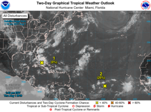
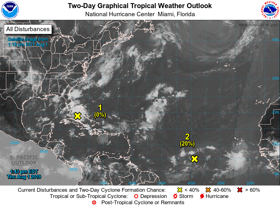
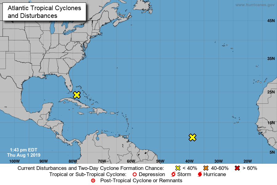
Atlantic 2-Day Graphical Tropical Weather Outlook
ZCZC MIATWOAT ALL
TTAA00 KNHC DDHHMM

Tropical Weather Outlook
NWS National Hurricane Center Miami FL
200 PM EDT Thu Aug 1 2019

For the North Atlantic...Caribbean Sea and the Gulf of Mexico:

1. An area of disturbed weather spreading across south Florida and the
Bahamas is forecast to move northward, producing additional locally
heavy rainfall over portions of the Florida peninsula during the
next day or two. Significant development of this system is not
expected before it merges with a front and accelerates northeastward
off the southeastern U.S. coast on Sunday.
* Formation chance through 48 hours...low...near 0 percent.
* Formation chance through 5 days...low...near 0 percent.

2. A broad low pressure system located about 1100 miles west-southwest
of the Cabo Verde Islands is producing limited shower and
thunderstorm activity. Slow development of this system is expected
during the next few days while it moves west-northwestward at 10 to
15 mph, and a tropical depression is likely to form several hundred
miles east of the Lesser Antilles. Environmental conditions are now
forecast to become unfavorable for additional development by early
next week as the system approaches the Lesser Antilles.
* Formation chance through 48 hours...low...20 percent.
* Formation chance through 5 days...high...70 percent.

Forecaster Zelinsky/McElroy