Published 23 July 2020
Buckie Got It, St. Kitts and Nevis News Source
Article by
Barbados TodaynPublished on July 23, 2020
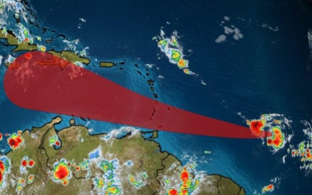
At 2 p.m. today, Tropical Storm Gonzalo was located near 9.7N 48.8W or about 760 miles/1230 KM East South East of Barbados. Maximum sustained winds have decreased to 60 MPH…95 KM/H. Present Movement…W or 270 degrees at 14 MPH or 22KM/H. Minimum central pressure…1000 MB…29.53 inches.
Gonzalo is currently encountering a dry environment which is contributing to its weakening. Despite this, some re-strengthening is possible during the next couple of days, and there is still a chance that Gonzalo could become a hurricane. The intensity forecast remains very problematic and of low confidence due to the small size of the cyclone and occasional dry air entrainment.
A general westward to west-northwestward motion with an increase in forward speed is expected through the weekend. On its current forecast track, the centre of Tropical Storm Gonzalo is expected to pass approximately 130 miles (210 km) to the south of Barbados on Saturday.
Earliest arrival of winds:-Sustained storm force winds are likely to spread across Barbados from the morning of Saturday 25, July with a chance of increasing to hurricane force by Saturday afternoon. During which time, sustained wind speeds of 70 to 80 mph (110 to 130 km/h) with higher gusts are likely to affect the island. Tropical Storm Gonzalo is also likely to generate rough to very rough sea swells. An advisory for this hazard will be issued under the marine products in the coming hours.
The next complete advisory will be issued at 5 p.m.
A Hurricane Watch means that hurricane conditions are possible within the watch area. A watch is typically issued 48 hours before the anticipated first occurrence of hurricane-force winds, conditions that make outside preparations difficult or dangerous.