Published 11 November 2020
Buckie Got It,
Basseterre St. Kitts and Nevis News Source
Weather Bulletin
Issued at: 7am Wednesday, 11th November
2020
FLASH FLOOD WATCH STATEMENT WHCA31 TAPA
BULLETIN
FLASH FLOOD WATCH
ANTIGUA AND BARBUDA METEOROLOGICAL SERVICES
5:00 AM ECT WED NOV 11 2020
…FLASH FLOOD WATCH IN EFFECT UNTIL 5 PM…
A FLASH FLOOD WATCH IS IN EFFECT FOR FLASH-FLOOD
PRONE AREAS OF ANTIGUA, BARBUDA, MONTSERRAT, ST.
KITTS, NEVIS, ANGUILLA, AND THE BRITISH VIRGIN ISLANDS.
THE FLASH FLOOD THREAT LEVEL IS MODERATE AND THERE
IS THE POTENTIAL FOR SIGNIFICANT IMPACTS IN THE WATCH
AREA. TO BE SAFE,IMPLEMENT YOUR FLOOD PLAN.
THE PROXIMITY OF TROPICAL DISTURBANCE AL98 WILL KEEP
THE WEATHER UNSETTLED. THIS WILL RESULT IN PERIODS OF
RAIN OR SHOWERS, WITH SOME LIKELY HEAVY AND POSSIBLY
THUNDERY. RAINFALL RATES OF 50 MM (2 IN) PER HOUR OR
MORE WILL PRODUCE MINOR FLOODING AND MAY PRODUCE
MODERATE OR WORSE FLASH FLOODING. A FLASH FLOOD
WATCH MEANS THAT FLOODING IS POSSIBLE BUT NOT
IMMINENT IN THE WATCH AREA.
LOCALISED DISRUPTION TO TRANSPORTATION;
INTERRUPTION OF SCHOOL HOURS; LOCALISED POPULATION
DISPLACEMENT; EROSION; ENVIRONMENTAL DEGRADATION;
LOCALISED DAMAGE TO DAMS, EMBANKMENT,IRRIGATION
AND DRAINAGE FACILITIES; HIGH SEDIMENTS TRANSPORT
INTO RESERVOIR; LOCALISED DISRUPTION TO
COMMUNICATION; LOCALISED CONTAMINATION OF POTABLE
WATER; LOCALISED LOSS OF LIVESTOCK; FINANCIAL LOSSES;
INJURIES; TEMPORARY STOPPAGE OF HEALTH SERVICES AND
DAMAGE TO INFRASTRUCTURE.
RESIDENTS IN FLASH-FLOOD PRONE AREAS SHOULD MAKE
PREPARATIONS TO PROTECT LIFE, PROPERTY AND
LIVELIHOOD AGAINST FLOODING AND BE PREPARED TO MOVE
TO HIGHER GROUND,IF HEAVY RAINS DEVELOP.
FORECASTER
DALE DESTIN
Weather Bulletin
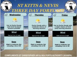
Issued at: 7am Wednesday, 11th November 2020.
Present Weather: Cloudy skies
Winds: A gentle breeze of 12mph from an easterly direction
Temperature: 26°C / 77°F Humidity: 85%
Sea Level Pressure: 1014.5mbs or 29.96mb
Sunrise: Tom 6:14am Sunset: Today 5:35pm
Weather Forecast Valid until 8am Tomorrow
Flash flood watch remains in effect for St. Kitts & Nevis
until 5pm Wednesday.
Due to the persistent rain that is forecast along with some moderate to heavy showers possible, conditions would be conducive for flash flooding. Residents are advised to exercise extreme caution in areas that are known for street flooding and rock fall such as the Old Road Bay area; also areas that are known for flash flooding including the ghauts.
Winds: East at 9 to 18mph, gusting to 30 mph.
Seas: 1 to 2 metres or 3 to 6 ft.
Weather Forecast for St. Kitts & Nevis: Tropical Disturbance
AL98 and associated troughs are expected to cause more wet weather
across the area. Possible rainfall total for the forecast period is 25 to
75 mm or 1 to 3 inches. A flash flood watch is in effect.
Weather today: Cloudy with periods of rain or showers and a 30
percent or a low chance of thunderstorms.
Weather tonight: Cloudy with a 90 percent or very high chance of
periods of rain or showers and a 30 percent or a low chance of
thunderstorms.
Eastern Caribbean Forecast: The proximity of Tropical
Disturbance AL98 will keep unsettled weather across much of the area.
Periods of rain or showers are expected across all of the islands.
Thunderstorms are also expected across Puerto Rico and the Virgin
Islands, and possible elsewhere. Possible rainfall total is 25 to 100 mm
or 1 to 4 inches, mainly across the Leeward Island, the Virgin Islands
and Puerto Rico.