Published 29 June, 2021
Basseterre
Buckie Got It, St. Kitts and Nevis News Source
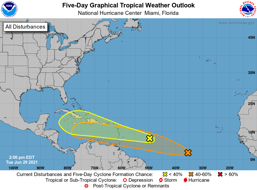
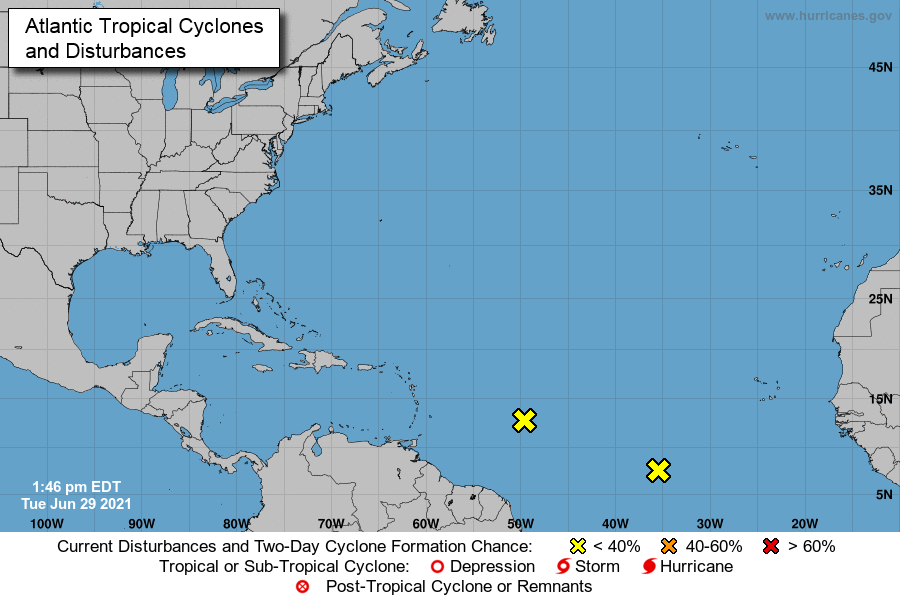
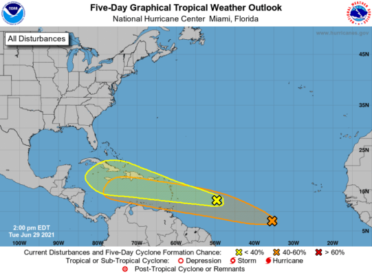
Tropical Weather Outlook
NWS National Hurricane Center Miami FL
200 PM EDT Tue Jun 29 2021

For the North Atlantic...Caribbean Sea and the Gulf of Mexico:


1. Disorganized showers and thunderstorms continue in association with
a tropical wave located over the tropical Atlantic about 650 miles
east of the Lesser Antilles.  Some slow development of this
disturbance is possible later this week while the system moves
westward to west-northwestward at 20 to 25 mph, likely reaching the
Lesser Antilles by Wednesday night.  Regardless of development,
this system could bring locally heavy rainfall to portions of the
Lesser Antilles during the next few days.
* Formation chance through 48 hours...low...20 percent.
* Formation chance through 5 days...low...30 percent.


2. Shower activity associated with a tropical wave located about 900
miles southwest of the Cabo Verde Islands continues to show signs
of organization.  Additional development of this system is possible
during the next several days as it moves generally west-
northwestward at about 20 mph.
* Formation chance through 48 hours...low...20 percent.
* Formation chance through 5 days...medium...40 percent.

Forecaster Beven