Published 13 August 2024
Buckie Got It
St. Kitts and Nevis News Source
TROPICAL STORM ERNESTO CONTINUES TO STRENGTHEN AS IT MOVES AWAY FROM ST. KITTS AND NEVIS
BASSETERRE, St. Kitts, August 13, 2024 (SKNIS): The National Emergency Management Agency (NEMA) issued an important update on Tropical Storm Ernesto as of 5:00 PM, on Tuesday, August 13, 2024. The storm’s centre continues to move away from St. Kitts and Nevis, while it strengthens further.
Residents should be prepared for additional moderate to heavy showers, with the possibility of thunderstorms over the next few hours. Winds are expected to be near storm-force strength, with higher gusts at times, but these conditions will gradually subside as Tropical Storm Ernesto moves further away from the Federation.
The expected weather conditions are as follows: Tonight, there will be cloudy skies with brief evening showers and a slight chance of thunderstorms. Tomorrow, the clouds will decrease, with a moderate chance of morning showers.
Despite the storm moving away, a flash flood warning remains in effect for St. Kitts and Nevis at this time. The tropical storm warning also remains in effect but is expected to be discontinued at 8:00 PM tonight. Additionally, the small craft warning will be downgraded to an advisory tomorrow as marine conditions are anticipated to improve.
NEMA urges all residents to continue exercising caution, especially when venturing outdoors, and to stay informed by monitoring updates from official channels.
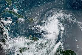
As of 5:00 PM, the centre of Tropical Storm Ernesto was located at 18.0°N, 64.1°W, approximately 104 miles northwest of St. Kitts and Nevis. The storm is moving west-northwest at 18 mph, with maximum sustained winds of 60 mph and a minimum central pressure of 1001 millibars.
NEMA will continue to provide updates as necessary. Please prioritise safety and adhere to all advisories.