Published 19 August 2020
Buckie Got It, St. Kitts and Nevis News Source
Article by
Barbados Today
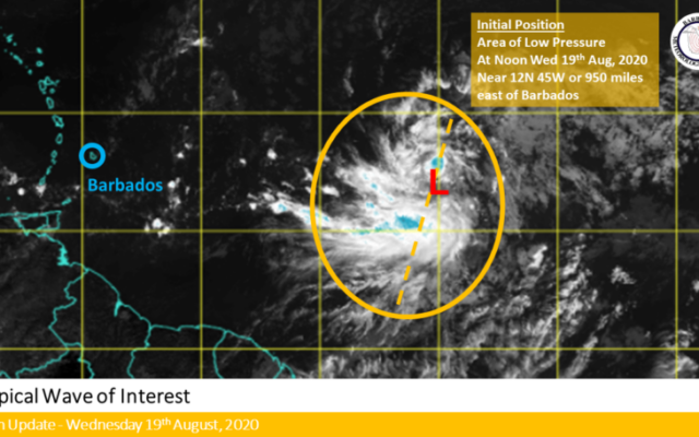
The Barbados Meteorological Services continues to monitor a tropical wave with an associated area of low pressure near 12 degrees north, 45 degrees west or about 950 miles to the east of Barbados. This feature is presently embedded in the monsoon trough and is maintaining deep convective activity as seen on satellite imagery.
The forecasters say conditions over the next few days are favourable for the system to slowly develop into a tropical depression.
The system is expected to move west-northwestward across the Tropical Atlantic and on its current track it is likely to pass well north of Barbados on Friday and therefore poses no threat to the island.
The Met Office says as the system moves towards the west-northwest, trailing moisture and instability is likely to bring occasional shower activity to the island from Friday night into Saturday morning.
It has advised the public to monitor official sources for updates over the next few days. The next update will be tomorrow at noon or sooner if conditions warrant.