Published 26 July 2023
Basseterre
Buckie Got It Media Source
GSD TO CONDUCT BATHYMETRIC SURVEYS IN ST. KITTS AND NEVIS; FISHERMEN AND OTHER SEA VESSEL OPERATORS ASKED TO TAKE NOTE
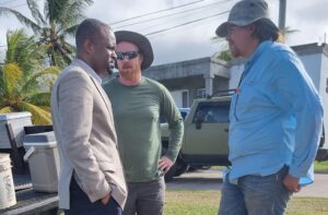
Basseterre, St. Kitts, July 26, 2023 (SKNIS): St. Kitts and Nevis is partnering with Global Support and Development (GSD), a humanitarian organization whose mission is to rapidly respond to disasters in collaboration with at-risk communities and support them to prepare for future disasters, to enhance coordination and resource mobilization, enabling timely and effective responses to natural hazards.
One of the capacity-strengthening exercises they will undertake is a comprehensive baseline bathymetric survey to assess the characteristics and profile of the seabed, enhancing the region’s understanding of its maritime infrastructure. This survey will enable data-driven decision-making and pave the way for effective coastal resource management and rapid post-disaster assessments in support of reopening maritime infrastructure.
The bathymetric survey will take place from Thursday 27th to Friday 28th July, 2023 in St. Kitts and Nevis waters. Fishermen and operators of other sea vessels are to take note of the activity when they see boats driving off the coast.
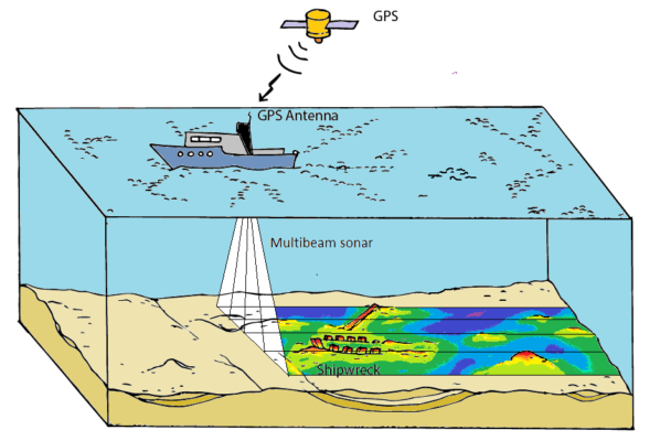
Bathymetric surveys map the underwater characteristics of the seabed to establish a baseline, particularly in areas where there is maritime infrastructure like ports.
The bathymetric survey will be conducted using a method called multibeam surveying, in which a multibeam echo sounder attached to a boat sends out sound waves, and the seafloor depth is computed by measuring the time it takes for the sound to leave the array, hit the seafloor, and return to the array. Multibeam sonars also can collect measurements for features that reflect sound in the water, which can reveal objects like debris from shipwrecks.
The data will help us to establish a baseline of the seabed surrounding the islands. In the event of a storm or other natural hazard, this baseline data will allow us to more easily identify or locate debris or other materials displaced by a storm, and help responders prioritize what needs to be addressed to reopen ports and shipping lanes. The data can also be used to track coastal erosion, sea level rise, and other changing coastline features.
Most maritime maps of St. Kitts and Nevis were mapped through lead line mapping nearly 100 years ago. This survey will provide maps that are both up-to-date and more comprehensive than existing maps. The data will be available in 2D and 3D and can be overlaid on Google Maps to increase accessibility.