Published 28 July 2020
Buckie Got It, St. Kitts and Nevis News Source
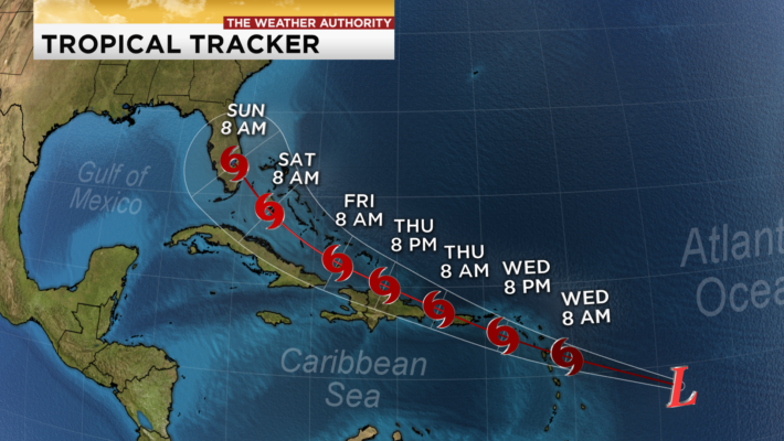
Tropical Storm Warning now in effect for St. Kitts and Nevis for Potential Tropical Cyclone #9
SUMMARY OF 1100 AM AST…1500 UTC…INFORMATION
———————————————–
LOCATION…13.8N 53.7W
ABOUT 585 MI…940 KM ESE OF THE LEEWARD ISLANDS OR ABOUT 645 MILES TO SOUTEAST OF ST. KITTS AND NEVIS.
MAXIMUM SUSTAINED WINDS…40 MPH…65 KM/H
PRESENT MOVEMENT…W OR 280 DEGREES AT 23 MPH…37 KM/H
MINIMUM CENTRAL PRESSURE…1007 MB…29.74 INCHES
On the forecast track, the system is forecast to move through the Leeward Islands on Wednesday, and near or over the Virgin Islands and Puerto Rico
Wednesday night, and near or over Hispaniola on Thursday.
Maximum sustained winds are near 40 mph (65 km/h) with higher gusts. Some strengthening is expected during the next 48 hours, and the
system is forecast to become a tropical storm tonight or Wednesday.
Tropical-storm-force winds extend outward up to 230 miles (370 km) primarily to the northeast of the center.
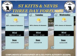
Potential Hazards to St. Kitts and Nevis
Wind: Storm force winds are expected across St. Kitts and Nevis by tomorrow through Thursday. Residents are asked to secure loose objects in and around their properties.
Rainfall: Possible total accumulations of 3 – 6 inches with higher totals possible. As such, flash flood warnings are likely to be issued by tomorrow. Residents in areas prone to flash
flooding and landslides are asked to exercise extreme caution.
Seas: Seas are expected to respond to the approaching potential tropical cyclone and as such they are likely to begin deteriorating sometime during the course of Wednesday 29th July into Thursday
30th July. Seas will become rough reaching 9 – 14ft and possible higher figures. Mariners are encouraged to secure their vessels today in advance of the system. Sea bathers are discouraged from
going into the seas during the passage of this system. It is expected to generate life-threatening waves and rip current.
Additional information will provided in the forecast this evening